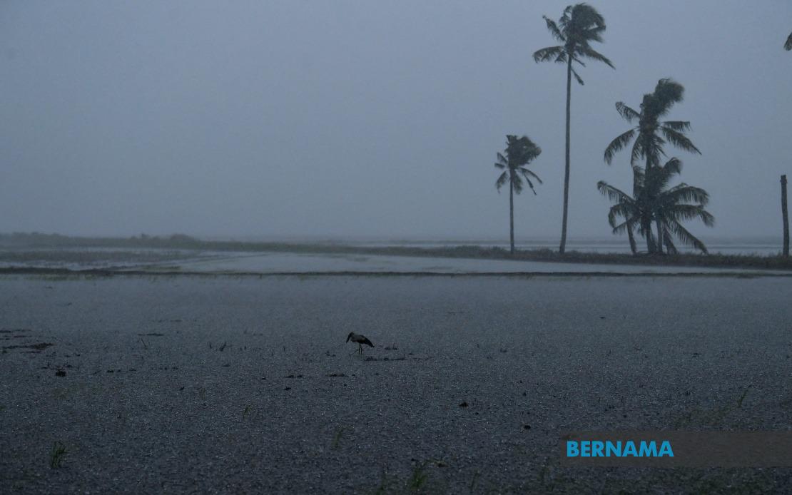
Malaysia's Meteorological Department has issued a severe weather alert affecting multiple districts across Peninsular Malaysia and Sabah, with conditions expected to persist until 2 pm today. The warning encompasses a broad swathe of the country, reflecting the typical pattern of afternoon convective activity during Malaysia's monsoon season. Residents and commuters in the affected regions are being advised to take precautions as the adverse conditions develop.
In Perak, three districts have been placed under the alert: Kerian, Bagan Datuk, and Hilir Perak. These areas, which span from the northern coastal plains to the central regions of the state, are particularly susceptible to rapid weather deterioration during the southwest monsoon period. The warning suggests that localised flooding and reduced visibility on major routes connecting these districts are possible hazards throughout the afternoon.
The neighbouring state of Selangor faces similar threats in Sabak Bernam and Kuala Selangor, both areas with significant population centres and commercial activity. Kuala Selangor's coastal location makes it especially vulnerable to storm surge effects when combined with heavy rainfall, while Sabak Bernam's low-lying agricultural zones frequently experience waterlogging during intense precipitation events. Commuters using the North-South Expressway and Federal routes serving these districts should expect potential delays and reduced visibility.
Negeri Sembilan's Jempol and Tampin districts are also under the thunderstorm alert, with both areas experiencing the convergence of moisture-laden winds typical of this season. Jempol, situated in the state's interior, is known for its topography that can amplify rainfall accumulation, while Tampin serves as a transit point for traffic between the southern Peninsular regions and the central states.
Melaka's inclusion covers Alor Gajah and Jasin, municipalities that have witnessed increased urbanisation and thus greater exposure for dense populations during severe weather events. The warning extends to Kota Tinggi in Johor, a district that has experienced significant flooding incidents in previous years when thunderstorms combine with high tide conditions.
In Sabah, the meteorological authority has identified three distinct vulnerable zones. The Interior region, encompassing Kuala Penyu and Beaufort, comprises sparsely populated but ecologically sensitive areas prone to landslides during torrential rainfall. The West Coast zone, which includes Kota Kinabalu, Penampang, Putatan, Papar, Tuaran, and Kota Belud, represents the state's most economically developed and densely inhabited corridor. This region's concentration of commercial, residential, and industrial infrastructure means that flooding and electrical storms pose significant risks to thousands of residents and businesses. Kudat in the north completes the alert zone, positioned at the tip of Sabah's maritime boundary.
The MetMalaysia warning specifically emphasises three hazards: thunderstorms, heavy rainfall, and strong winds. Thunderstorms bring the risk of lightning strikes, which can disrupt power supply and pose danger to outdoor workers and activities. Heavy rain creates flash flood potential, particularly in low-lying areas and near watercourses that may rise rapidly. Strong winds accompanying these storms can damage structures, uproot trees, and create hazards for vehicles and maritime traffic.
The 2 pm deadline for the alert is significant, as it suggests that meteorological models indicate the thunderstorm activity should diminish during the late afternoon and evening hours. However, residual rainfall and overcast conditions may persist beyond this window. This timing pattern is typical of Malaysia's afternoon convective thunderstorms, which develop as ground heating peaks during midday and early afternoon, then gradually weaken as solar heating decreases toward evening.
Residents in affected areas are typically advised to secure loose outdoor items, avoid unnecessary travel, seek shelter indoors when storms develop, and stay informed through official channels for updates or escalated warnings. Road users should exercise heightened caution, reduce speed, and increase following distances. Individuals engaged in water-based activities, construction work, or outdoor events should consider postponement or relocation to safer venues.
The geographic spread of this alert—from Perak in the north to Johor in the south, plus Sabah in Malaysian Borneo—reflects the extensive nature of the atmospheric conditions generating these storms. For Malaysian insurance and emergency management sectors, such alerts serve as important indicators for potential claims and resource deployment. Businesses relying on logistics and transportation should factor potential disruptions into their scheduling, while agricultural operations may need to implement protective measures for crops and livestock.
MetMalaysia continues to monitor atmospheric developments and will issue updated advisories should conditions change in intensity or duration. The public can access real-time weather information through the MetMalaysia website, mobile applications, and official social media channels. Early warning systems allow affected communities to implement protective actions before severe weather arrives, reducing potential casualties and property damage.

