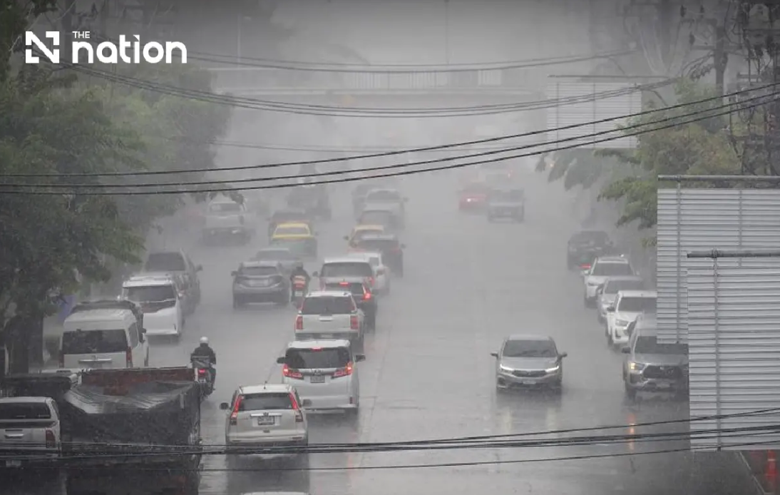
Thailand is bracing for significant flooding across its northern and northeastern regions as the Thai Meteorological Department (TMD) issued its ninth severe weather warning on Wednesday afternoon. The alert covers a three-day period extending through Friday, August 21, with particular concern centred on the risk of flash floods and dangerous runoff in vulnerable terrain. The convergence of a monsoon trough sweeping across the northern provinces and a strengthening southwest monsoon system has created atmospheric conditions primed for prolonged, heavy precipitation across upper Thailand.
The meteorological warning reflects growing concerns about accumulated rainfall in areas already saturated from earlier storms. Communities situated in foothill zones, near natural waterways, and in depression areas face the greatest hazard, as water flowing from higher elevations can inundate lower settlements with little warning. The TMD specifically cautioned residents living near drainage channels and in terrain susceptible to rapid water accumulation to remain vigilant and prepared for potential evacuation. The advisory underscores how Thailand's geography—with significant elevation changes from mountains to plains—creates inherent vulnerability to flash-flood phenomena during monsoon periods.
Transport disruptions loom as a serious secondary concern. The TMD advised motorists to plan journeys with extreme caution and to avoid roads with documented histories of seasonal flooding, particularly routes traversing low-lying corridors where water depths can rise unpredictably within hours. This guidance carries practical implications for commerce and daily life across affected regions, as supply chains and commuter patterns may face disruption. The recommendation to monitor official forecasts throughout the warning period reflects the dynamic nature of monsoon weather, where conditions can escalate or shift rapidly.
In the North, forecasters anticipate thunderstorms blanketing roughly 80 percent of the region from Wednesday evening through Thursday evening. Seven provinces are expected to experience very heavy downpours: Mae Hong Son, Lampang, Nan, Phrae, Uttaradit, Phitsanulok, and Phetchabun. An additional eight provinces—Chiang Mai, Chiang Rai, Phayao, Lamphun, Sukhothai, Tak, Kamphaeng Phet, and Phichit—face heavy rainfall classifications. Daytime temperatures will remain warm, ranging from 28 to 34 degrees Celsius, while overnight lows hover between 22 and 27 degrees. Light to moderate southwesterly winds of 10 to 20 kilometres per hour will accompany the rain system.
The northeastern plateau, Thailand's second-largest region by area, confronts equally challenging conditions. Storm coverage is forecast to affect 80 percent of the Northeast, with particularly severe rain expected in Loei, Nong Khai, Bueng Kan, Udon Thani, Sakon Nakhon, Nakhon Phanom, Kalasin, and Mukdahan. Twelve additional provinces face heavy rainfall warnings. The region's terrain, characterised by generally lower elevations and river valley systems that drain toward the Mekong, means that accumulated water from the higher northwest can flow into and collect across northeastern landscapes. Temperatures will range from 22 to 25 degrees Celsius at night and 27 to 32 degrees during the day.
The central region will experience somewhat lighter but still significant impacts, with thunderstorms covering approximately 60 percent of the area. Heavy rain is anticipated in Nakhon Sawan, Phra Nakhon Si Ayutthaya, Lop Buri, Saraburi, Kanchanaburi, and Ratchaburi. These provinces are particularly sensitive to river flooding, as they lie within major drainage basins that can swell rapidly when upstream areas receive prolonged rainfall. Daytime highs will reach 32 to 36 degrees Celsius, with night-time temperatures between 23 and 26 degrees. Southwesterly winds will strengthen to 10 to 25 kilometres per hour.
Eastern Thailand faces a 70 percent storm probability, with heavy rain predicted in Nakhon Nayok, Prachin Buri, Sa Kaeo, Chachoengsao, and Chanthaburi. The province of Trat merits special attention, with forecasts indicating potential for very heavy rainfall. Eastern coastal waters will see waves reach two to three metres in normal conditions, exceeding three metres during active thunderstorms. The combination of heavy rainfall inland and rough seas offshore creates a dual hazard environment affecting both inland agriculture and maritime activities.
Bangkok and surrounding provinces face a comparatively lower but non-negligible threat, with storms predicted to cover 60 percent of the metropolitan area. Isolated heavy rain could still occur within the Thai capital, adding complexity to urban flood management in a city where infrastructure struggles during intense precipitation events. Maximum temperatures will approach 33 to 35 degrees Celsius, with minimum temperatures of 25 to 27 degrees. Southwesterly winds will range from 10 to 25 kilometres per hour.
Maritime hazards extend across both major water bodies affecting Thailand. The upper Andaman Sea and upper Gulf of Thailand will experience waves of two to three metres, surging beyond 3 metres during thunderstorm activity. The lower Andaman Sea will see calmer conditions initially, with wave heights around two metres increasing during squalls. The TMD has mandated that all vessels proceed with caution and actively avoid thunderstorm cells. Small boats operating in the upper Andaman Sea and upper Gulf have been ordered to remain ashore through August 21, reflecting the severity of expected sea conditions. The southern coastal regions from Phetchaburi through Chumphon will experience 40 percent storm coverage, while waters off Nakhon Si Thammarat southwards will see winds reaching 15 to 35 kilometres per hour with wave heights exceeding two metres in severe weather.
The convergence of a monsoon trough and the southwest monsoon represents a common but dangerous meteorological pattern during Thailand's rainy season. When these systems overlap, they can produce slow-moving, stationary weather systems that dump extreme rainfall volumes over extended periods. For regions lacking sophisticated drainage infrastructure or situated in naturally flood-prone terrain, such conditions create genuine public safety emergencies. The TMD's repeated issuance of warnings—nine by Wednesday afternoon—signals that conditions are either failing to improve or deteriorating, necessitating continuous public communication.
For Malaysian and Southeast Asian observers, Thailand's flood situation carries broader relevance. The same monsoon systems affecting Thailand also influence weather patterns across Malaysia, Laos, Cambodia, and Myanmar. Understanding Thailand's meteorological challenges provides insight into regional climate dynamics and shared seasonal hazards. The intensity of current warnings may foreshadow similar conditions developing across neighbouring countries within days. Additionally, if significant flooding occurs in Thailand, potential impacts on cross-border rivers like the Mekong could generate downstream effects on Cambodia, Laos, and Vietnam.

