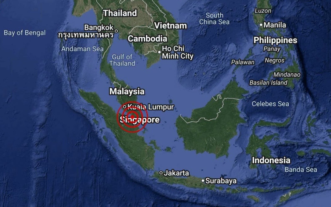
Malaysian seismic monitors recorded a weak earthquake measuring 3.1 magnitude in the waters off Batu Pahat, Johor, on Monday, August 25, at 4.12 pm local time. The tremor occurred at sea approximately 18 kilometres south-west of the Johor coastal town, according to data released by the Malaysian Meteorological Department through its National Weather and Earthquake Operations Centre.
The epicentre was precisely located at coordinates 1.7 degrees north and 102.8 degrees east, placing the disturbance well offshore in the Strait of Malacca region. While submarine earthquakes in Southeast Asian waters are not uncommon given the region's complex geological structure along tectonic plate boundaries, this particular event fell well within the lower magnitude range and posed no immediate hazard to populated areas or critical infrastructure along the Johor coast.
The Malaysian Meteorological Department promptly issued a public statement confirming that the earthquake posed no tsunami threat to Malaysia. This rapid assessment reflects standard protocol for seismic events in Malaysian waters, where authorities routinely evaluate tremor magnitude, depth, and location to determine potential hazard levels. Given the shallow-to-moderate depth typical of earthquakes in the Strait of Malacca and the modest 3.1-magnitude reading, the assessment that no tsunami conditions would develop was consistent with established scientific criteria.
For Malaysian residents in coastal areas of Johor, particularly around Batu Pahat and surrounding municipalities, the official clearance provided reassurance that no precautionary evacuation measures or special safety protocols were necessary. The town of Batu Pahat, situated on Johor's southern coastline and home to thousands of residents and commercial activities, could continue normal operations without disruption.
The incident underscores the ongoing seismic activity that characterises the geologically active region encompassing the Strait of Malacca and surrounding waters. Malaysia sits within a seismically active zone influenced by broader tectonic movements affecting Southeast Asia. While major destructive earthquakes remain relatively rare in Malaysian territory compared to neighbouring countries like Indonesia and the Philippines, minor tremors in offshore waters occur with regular frequency and are carefully monitored by MetMalaysia's sophisticated network of seismic sensors distributed across the nation.
The rapid detection and public communication of earthquake data represents an important component of Malaysia's disaster management infrastructure. MetMalaysia maintains real-time monitoring systems capable of identifying and analysing seismic events within seconds, enabling swift dissemination of critical information to the public and relevant emergency response agencies. This capability proved particularly valuable following the devastating 2004 Indian Ocean tsunami, which prompted enhanced monitoring and early warning systems throughout the region.
For Southeast Asia more broadly, earthquake monitoring remains a vital public safety function given the region's position along multiple tectonic plate boundaries. Indonesia, positioned on the Pacific Ring of Fire, experiences far more frequent seismic activity, while the Philippines similarly sits in a highly active zone. Malaysia, lying closer to the stable continental core of Southeast Asia, experiences notably fewer seismic events, making even minor tremors noteworthy enough to warrant immediate assessment and public notification.
The absence of tsunami risk following Monday's tremor reflects both the moderate magnitude of the earthquake and the specific oceanographic conditions of the Strait of Malacca. Unlike major subduction zone earthquakes capable of displacing enormous volumes of water, a 3.1-magnitude event simply lacks the energy required to generate significant wave disturbance. Furthermore, the relatively shallow waters and coastal topography of the strait would not amplify wave propagation even if minor underwater displacement had occurred.
Monitoring systems like those operated by MetMalaysia form the backbone of Malaysia's resilience against natural hazards. Beyond earthquake detection, the department maintains comprehensive meteorological monitoring networks that track typhoons, heavy rainfall events, and other weather-related phenomena that pose more frequent risks to the country than seismic events. The integration of multiple monitoring systems enables Malaysian authorities to provide integrated hazard assessments and early warnings across various natural disaster categories.
The incident on August 25 also illustrates the importance of public familiarity with official emergency channels and authoritative information sources. As earthquakes can trigger rapid spread of rumour and misinformation through social media, having clear communication from recognised authorities like MetMalaysia helps maintain public calm and prevents unnecessary panic. The department's swift confirmation that no tsunami threat existed provided immediate clarity to residents and businesses in potentially affected areas.

