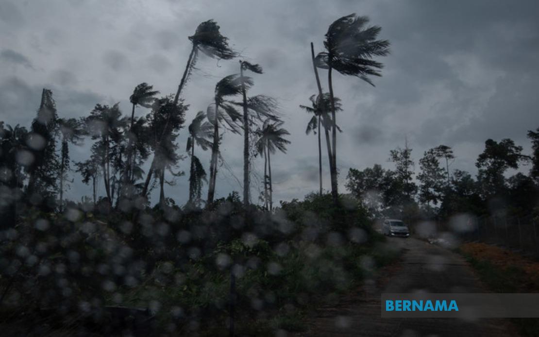
Malaysia's meteorological authorities have activated a widespread weather alert across nine states following forecasts of severe thunderstorms, torrential downpours, and gusty winds expected to sweep through the country. The Malaysian Meteorological Department (MetMalaysia) issued the advisory at 2.40 pm on August 19, cautioning residents and motorists in affected regions to exercise heightened caution as conditions were anticipated to remain hazardous until 5 pm that afternoon.
The northern region faces particular exposure, with six districts in Kedah placed under alert status. MetMalaysia identified Baling, Sik, Kulim, Kuala Muda, Pendang, and Yan as areas vulnerable to the incoming system, while neighbouring Penang's vulnerable zones encompassed the two Seberang Perai administrative divisions—Utara and Tengah—which contain significant population centres and major commercial hubs. The geographical concentration of warnings in the north reflects the typical progression patterns of thunderstorm systems during Malaysia's monsoon season, when atmospheric instability creates conditions favouring rapid storm development across the peninsula's western corridor.
Perak, situated between the northern and central zones, faced an expansive warning envelope covering seven administrative districts. Mualim, Kinta, Kampar, Batang Padang, Perak Tengah, Hilir Perak, and Kuala Kangsar represented a substantial geographical swath encompassing both urban and rural zones, from the state's industrial heartland around Ipoh through to its southern agricultural regions. The breadth of Perak's coverage suggests MetMalaysia detected widespread atmospheric conditions rather than isolated storm cells, implying potentially significant rainfall accumulation across diverse terrain and elevations.
The east coast of Peninsular Malaysia also fell within the warning zone. Terengganu's affected districts—Dungun, Marang, Kuala Terengganu, and Kuala Nerus—encompass the state's primary population concentrations and coastal regions particularly susceptible to intense convective activity. Pahang's warning covered considerably larger territory, with eight districts included: Cameron Highlands, Lipis, Raub, Bentong, Bera, Rompin, Temerloh, and Maran. This extensive coverage reflects Pahang's considerable size and the varied microclimates encountered across its highland, lowland, and riverine zones, where thunderstorms can produce hazardous conditions including flash flooding in low-lying areas.
Central Malaysia's Negeri Sembilan registered five districts under alert—Seremban, Jempol, Tampin, Kuala Pilah, and Jelebu—while Johor, despite being the nation's largest state by area, faced alerts only in Segamat. This differentiation likely reflects MetMalaysia's assessment that the storm system's most intense activity would remain concentrated in northern and central peninsular zones rather than extending substantially southward toward Johor's populated heartland.
East Malaysia experienced similarly extensive warnings, demonstrating that the atmospheric disturbance affected the broader region beyond the peninsula. Sarawak's warning extended across multiple divisions, encompassing Miri's subdivisional area of Marudi, the northern border district of Limbang, and central coastal zones including Mukah and the Sibu division encompassing both Sibu and Selangau. Additionally, the Sarikei division's localities of Maradong and Sarikei, along with Bintulu division covering both Bintulu and Tatau, fell under alert status. This distribution suggests the storm system possessed sufficient geographic scope to influence weather patterns across Sarawak's varied terrain.
Sabah similarly recorded multiple alert zones concentrated in specific administrative areas. The Interior Division encompassing Keningau, Tambunan, Membakut, Tenom, Sipitang, and Beaufort—largely highland and mountainous terrain where thunderstorms can intensify rapidly—joined the West Coast and Kudat divisions' Kota Marudu in the warning inventory. The clustering of Sabah's alerts in inland and western zones suggests MetMalaysia identified particular vulnerability in these regions to severe convective development.
Thunderstorm warnings of this scope carry significant implications for daily life across affected regions. Motorists on major highways traversing warned districts face reduced visibility, slippery road surfaces, and potential debris hazards. Agricultural activities, construction work, and outdoor events require postponement or enhanced safety protocols. Coastal communities in warned areas should remain vigilant regarding sudden wind shifts and localized flooding, while residents in highland zones like Cameron Highlands and Sabah's Interior Division may experience particularly intense rainfall rates capable of triggering flash floods in drainage-prone areas.
The issuance of such comprehensive warnings reflects MetMalaysia's commitment to public safety through timely hazard communication. By specifying affected districts rather than issuing state-level alerts alone, the department enables targeted preparedness and response measures. The defined endpoint of 5 pm provided residents with a clear timeframe for exercising caution, after which conditions were anticipated to stabilize. For Malaysian and Southeast Asian observers, such weather systems underscore the importance of maintaining updated weather monitoring protocols throughout the region's extended monsoon seasons, when atmospheric energy frequently generates severe weather affecting multiple jurisdictions simultaneously.

