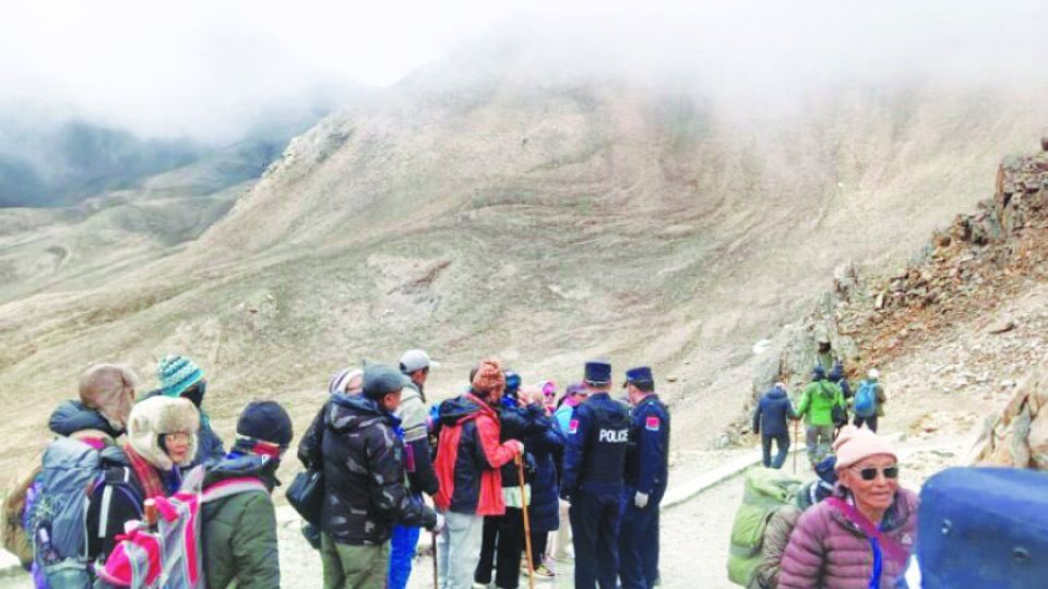
India and China have formally inaugurated bilateral trade through the Lipulekh Pass, proceeding despite sustained Nepali objections regarding the passage's location within Kathmandu's claimed territory. The commencement of commercial operations on August 1 represents a significant escalation in a territorial dispute that has festered across nearly a decade, with Nepal consistently asserting that the route traverses its sovereign domain rather than the tripoint boundary where India and China insist it lies.
According to Nepal's official delineation of its western boundary with India, the Lipulekh Pass sits approximately 56 kilometres beyond Limpiyadhura, the reference point from which Kathmandu measures its frontier. This geographical claim forms the foundation of Nepal's repeated diplomatic protests to both New Delhi and Beijing. The dispute reflects deeper tensions over competing interpretations of colonial-era treaties, particularly the 1816 Treaty of Sugauli, which Nepal contends clearly designates the Mahakali River as its western boundary. For Kathmandu, this historical accord unambiguously places the contested territories—Kalapani, Lipulekh, and Limpiyadhura—within Nepali sovereignty.
The inaugural trading convoy transported 16 Indian merchants accompanied by four support personnel across the pass to Taklakot in Tibet on opening day. The Pithoragarh district administration in India had authorised 134 traders for cross-border commerce, though Chinese authorities initially restricted entry to merely 20 individuals, signalling cautious management of the initiative. This selective opening reflects ongoing coordination challenges and perhaps acknowledgement of the contentious political backdrop. The resumption concludes a six-year suspension that began in 2019, when Covid-19 pandemic restrictions shuttered the route entirely.
The passage has undergone substantial infrastructural transformation to accommodate modern commercial operations. For the first time in its trading history, the route now facilitates vehicle-based transport rather than reliance on traditional pack animals such as yaks, horses, and mules. However, this advancement contains important limitations: regulations mandate that goods traverse approximately 500 metres near the border crossing on pack animals due to security and administrative constraints, beyond which motorised transport becomes feasible. This hybrid arrangement reflects the sensitive nature of the crossing and the necessity for both governments to maintain visible security oversight.
Both nations had originally scheduled the passage's reopening for June 1, but logistical complexities necessitated postponement to August. The intervening period witnessed intensive coordination encompassing trader permit finalisation, currency exchange banking designations, customs facility establishment, and bilateral administrative arrangements. Supporting infrastructure demanded equal attention: officials engineered transit camps, accommodation facilities, banking services, telecommunications connectivity, security apparatus, and medical provisioning to ensure operational viability for cross-border merchants.
Under the extant India-China border trade framework, Indian merchants may procure Tibetan wool, pashmina, salt, silk, butter, yak hair, and animal hides for onward distribution. Conversely, Indian exporters supply garments, blankets, spices, flour, dried fruits, vegetables, copper commodities, agricultural implements, stationery, footwear, and vegetable oil through the designated passage. Beyond commerce, India utilised the route this year to facilitate religious pilgrims undertaking the Kailash Mansarovar Yatra, integrating both trade and spiritual movement through the disputed corridor.
Nepal has responded to this unilateral reopening with formal diplomatic protests, reaffirming its territorial claims through official channels. On May 3, Nepal's Ministry of Foreign Affairs transmitted formal objections to both India and China, reasserting that Kalapani, Lipulekh, and Limpiyadhura constitute incontestable Nepali territories pursuant to the Treaty of Sugauli. Kathmandu has consistently maintained that the 1816 accord unmistakably identifies the Mahakali River as Nepal's western demarcation, positioning all eastward territory under Nepali administrative control.
The present dispute trajectory originated in 2015 when Indian Prime Minister Narendra Modi and Chinese President Xi Jinping agreed during Modi's Beijing visit to stimulate bilateral trade through the Lipulekh passage. This accord provoked immediate condemnation from Nepal's then-administration under Prime Minister Sushil Koirala, which transmitted diplomatic notes expressing categorical opposition. The objection pattern intensified following India's 2019 release of a revised political map depicting Calapani, Lipulekh, and Limpiyadhura within Indian territory—a cartographic repositioning that prompted additional Nepali protests and demands for dialogue-based boundary resolution.
Catching Kathmandu's consistent diplomatic refusals to produce meaningful negotiation, Nepal enacted a constitutional amendment in June 2020 and published an updated official map incorporating the three contested territories within Nepali jurisdiction. This countervailing claim represented institutional crystallisation of Nepal's position, translating diplomatic protest into constitutional recognition. India's parallel road construction through the disputed region further intensified tensions, demonstrating through infrastructure investment the permanence both New Delhi and Beijing ascribe to their territorial interpretation.
For regional observers including Malaysia and other Southeast Asian nations, this episode illustrates the persistence of colonial-era boundary demarcations in generating contemporary geopolitical friction. The dispute underscores how historical treaties remain subject to competing interpretations, particularly when colonial documents contain ambiguous geographical references. The India-Nepal-China triangular tensions carry implications for regional stability and multilateral engagement frameworks, as boundary conflicts between neighbouring powers often constrain cooperative mechanisms and create diplomatic complications affecting third parties.
The passage's reopening reflects broader India-China normalisation efforts following recent military confrontations along their shared border. Yet this apparent rapprochement occurs deliberately and pointedly across territory that Nepal contests, suggesting both powers are consciously willing to subordinate Nepali objections to bilateral commercial and strategic interests. For Nepal, the passage's operational commencement without meaningful concessions represents a significant diplomatic setback, demonstrating that smaller neighbouring nations encounter limited leverage when larger powers prioritise bilateral interests over territorial accommodation.
Looking forward, the trade corridor's sustainability depends upon whether both India and China maintain operational commitment despite Nepali protests, or whether international pressure and Nepal's own constitutional assertions ultimately compel renegotiation. The episode reveals evolving power asymmetries within South Asian international relations and challenges assumptions regarding small-state agency in boundary disputes involving major powers with competing strategic interests.

