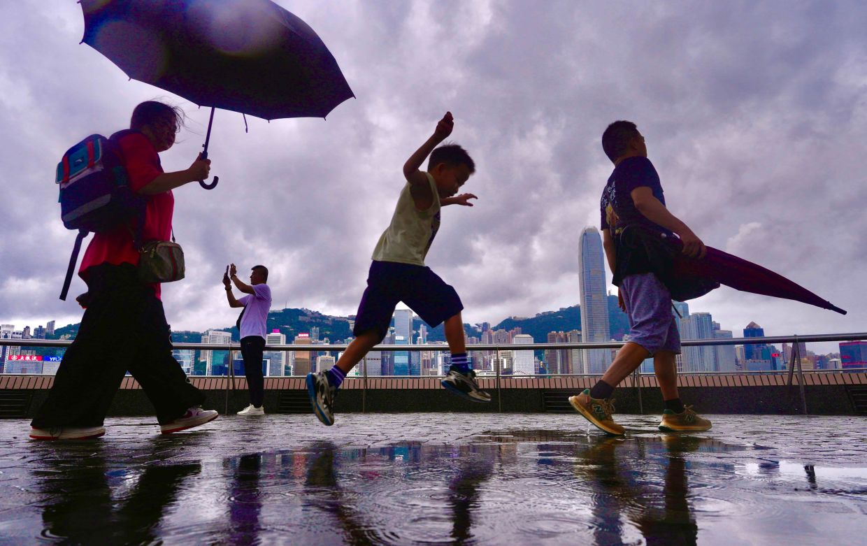
Hong Kong residents finally experienced the cooling touch of rain on Friday morning as widespread precipitation swept across the territory, providing respite from an oppressive heat wave that had gripped the city for the past seven days. The Hong Kong Observatory issued a lowest-tier amber rainstorm warning at 8:40 am as showers and squally thunderstorms developed, canceling the alert just three hours later as conditions stabilized. The arrival of the moisture-laden system offered blessed relief to a population that had endured relentless scorching temperatures throughout the preceding week.
The meteorological conditions that triggered the rainfall were driven by upper-air disturbances interacting with a southwesterly airstream, a weather pattern combination that pushed moisture inland from the South China Sea. The observatory had forecast continued showers and thunderstorms throughout Friday as the system moved across the territory, with additional precipitation expected in some areas on Saturday morning before clearing skies emerged during afternoon hours. The weekend outlook suggested a return to sunny intervals and warm conditions as the system moved offshore, though meteorologists warned that very hot weather would resume early in the following week alongside isolated showers.
The intensity of the preceding heat wave underscored the severity of climatic pressures facing Hong Kong. During the week leading up to Friday's rainfall, temperatures had soared past 34 degrees Celsius across numerous districts, creating dangerous conditions that prompted residents to seek shelter indoors and forced authorities to issue health warnings. The sustained nature of the extreme temperatures proved particularly noteworthy, with the Hong Kong Observatory recording maximum readings of 33 degrees Celsius or higher for an unprecedented nine consecutive days during August—a duration that surpassed all previous records for the longest continuous hot period in the month.
Perhaps most alarming was the absolute temperature peak reached during this period. On Sunday prior to the rainfall event, the observatory recorded a maximum of 36.9 degrees Celsius, marking the highest temperature since systematic weather recording commenced in 1884. This historic reading, logged at the observatory's official measuring station, signaled not merely a passing spell of summer warmth but rather an extreme weather event that shattered established baselines for the hottest conditions the territory has experienced in nearly a century and a half of meteorological documentation.
For Malaysian readers and the broader Southeast Asian region, Hong Kong's experience carries significant implications. The southern Chinese territory sits at the northern edge of the subtropical zone where Malaysia operates, and both regions share similar monsoon patterns and climatic vulnerabilities. Hong Kong's intensifying heat waves reflect broader climate trends affecting the entire region, suggesting that extreme summer temperatures may become increasingly common across Southeast Asia. The heat wave also raised questions about urban heat island effects, as Hong Kong's dense development and limited green spaces can amplify temperature extremes compared to surrounding coastal areas.
The temporary nature of the relief provided by Friday's rainfall highlighted the precarious balance of the region's weather systems during late summer. While the moisture brought welcome cooling and hydration to the city's reservoirs, meteorologists emphasized that the return of very hot conditions early the following week would maintain drought pressures. Such feast-or-famine precipitation patterns—alternating between intense rainfall events and extended dry, scorching periods—create challenges for water resource management throughout the region, as seen in Malaysia's own water security discussions.
The breaking of multiple temperature records within a single week demonstrates the accelerating nature of extreme weather events in the region. Climate scientists have increasingly documented how global warming is not merely causing average temperatures to rise, but is also extending the duration of heat waves and pushing peak temperatures to new extremes. Hong Kong's nine consecutive days of dangerous heat and its highest-ever recorded temperature both illustrate this concerning pattern, raising questions about how Southeast Asian cities are preparing infrastructure, public health systems, and emergency response capabilities for an era of more frequent and intense thermal stress.
The Hong Kong Observatory's issuance of weather alerts reflected the serious public health dimensions of the heat wave. Beyond discomfort, sustained temperatures exceeding 33-36 degrees Celsius pose genuine risks of heat exhaustion and heat stroke, particularly among vulnerable populations including the elderly, those with chronic illnesses, and outdoor workers. The early morning timing of the Friday rainfall—during the cooler morning hours—helped moderate peak afternoon temperatures that would have otherwise reached dangerous levels.
Looking ahead, the forecast pattern suggesting a temporary respite followed by a return to extreme heat underscores the instability of the atmospheric conditions affecting southern China and Hong Kong in late summer. The interplay between stable high-pressure systems and tropical moisture streams creates a dynamic environment where dramatic swings in weather are possible, but where heat-dominated patterns appear to have become increasingly entrenched. For Malaysia and other Southeast Asian nations monitoring regional climate trends, Hong Kong's experience serves as a cautionary reminder of the intensifying thermal challenges facing tropical and subtropical Asia.

