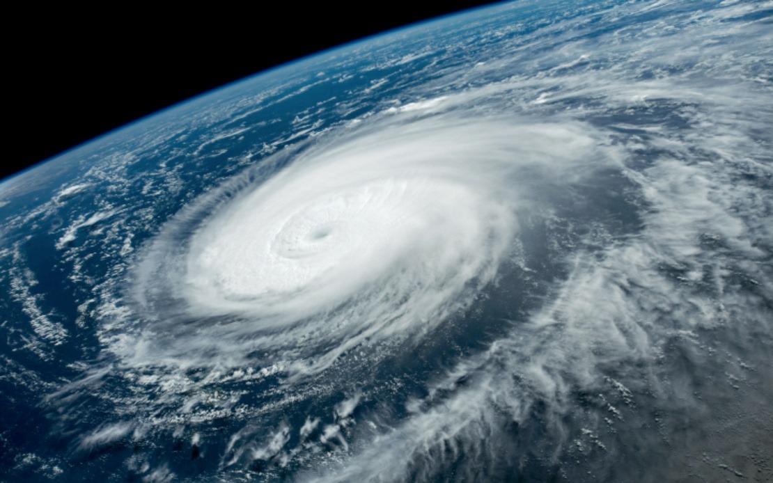
Eastern China is bracing for a potentially severe weather event as Typhoon Dolphin moves toward the mainland coast, triggering one of the country's highest alert levels and prompting sweeping precautionary measures across multiple provinces. China's meteorological authority on Saturday elevated its emergency response designation for Dolphin to Level III and upgraded the typhoon warning from yellow to orange, signalling official recognition that the approaching system poses substantial risk to coastal populations and infrastructure.
The anticipated landfall corridor stretches across a densely populated zone, with forecasters projecting that Typhoon Dolphin will make contact with the coast between Zhoushan in Zhejiang Province and Fuding in Fujian Province during the transition from Sunday night into Monday morning. This timing and positioning put major population centres and economically vital coastal regions directly in the path of expected severe winds and heavy precipitation, necessitating coordinated action across provincial and municipal administrations.
Zhejiang Province, home to Shanghai and numerous port facilities, has activated its second-highest typhoon emergency response level. The provincial government has deployed more than 4,000 monitoring personnel tasked with inspecting over 7,500 locations identified as vulnerable to secondary hazards including landslides and structural failures. This preventive surveillance reflects lessons learned from previous typhoon events and underscores the sophistication of China's disaster management approach, which extends beyond immediate storm preparedness to encompass geological risks triggered by extreme rainfall.
The scale of maritime and construction activity suspended in Zhejiang demonstrates the region's integration into global supply chains and the substantial economic footprint of coastal operations. All 162 passenger ferry routes have been shut down, effectively isolating island communities and disrupting civilian transport networks. Simultaneously, work has halted at 193 offshore projects—ranging from energy installations to infrastructure development—while 474 construction vessels have been ordered to shelter in port. These measures, completed by Friday morning, represent a preemptive shutdown of activities that could be imperilled by storm surge and high winds.
Fujian Province has implemented analogous precautions calibrated to its own maritime economy. Authorities suspended 40 passenger ferry routes and ceased operations at 115 offshore construction sites by Saturday noon. Of particular significance, all 1,210 registered fishing boats operating from the coastal city of Fuding had returned to port, reflecting the vulnerability of small fishing fleets to typhoon conditions and the reliance of local communities on seafood industries. The coordinated inland movement of these vessels represents a significant economic disruption but also a critical protective measure that potentially saves lives.
Shanghai, despite its distance from the projected landfall zone, issued a blue-level typhoon alert on Friday as meteorologists warned of a multi-day impact window. Forecasters anticipate four days of strong winds and heavy rainfall affecting the megacity and surrounding regions. The Yangtze River Delta, one of the world's most economically concentrated areas, faces partial suspension of train services beginning Sunday, amplifying the ripple effects across the region's integrated transport and logistics infrastructure. For Malaysian businesses and investors with operations in this region, the disruption signals potential delays in manufacturing, shipping, and supply chain continuity.
The comparative severity assessment provided by Xu Yinglong, chief forecaster at the National Meteorological Centre, positions Typhoon Dolphin as a more dangerous system than Typhoon Bavi, which made landfall in July. Dolphin's anticipated stronger winds and heavier rainfall suggest accumulated moisture and intensity metrics that exceed its predecessor, justifying the elevated alert posture. This technical evaluation by China's premier weather authority carries substantial weight in regional meteorological circles and influences preparedness decisions throughout Southeast Asia.
China's four-tier colour-coded warning framework—with red representing maximum severity, followed by orange, yellow, and blue—provides standardised communication to the public and coordinating agencies. The parallel emergency response system, with Level I denoting the highest activation, creates a dual-measure approach that allows fine-grained calibration of governmental action. The decision to elevate Dolphin to Level III (second-highest) rather than Level I suggests that while the system merits serious preparation, authorities judge it unlikely to trigger the most extreme contingency measures reserved for potentially catastrophic events.
The implications for Malaysia and the broader region extend beyond immediate weather impacts. Supply chain disruptions in China's manufacturing heartland and transportation corridors directly affect Malaysian import-dependent sectors, from technology components to raw materials. Shipping schedules through regional ports may face delays, influencing inventory management and production timelines for Malaysian manufacturers integrated into East Asian supply networks. Additionally, the severity of weather systems affecting China's eastern seaboard historically correlates with systems that subsequently influence Southeast Asian weather patterns, making the trajectory and intensity of Typhoon Dolphin relevant to regional meteorological forecasting.
The mobilisation of thousands of monitors, coordinated inter-provincial responses, and preemptive infrastructure shutdowns reflect the institutional capacity China has developed for disaster management. However, the event also underscores the persistent vulnerability of densely populated coastal zones to severe weather, a challenge shared across Southeast Asia. For Malaysian policymakers and emergency management officials, the Chinese response serves as both a benchmark for preparedness standards and a reminder of the transnational nature of meteorological hazards in the region.

